Cloud cover affecting PastureKey Estimates
Summary of the effect of cloud cover and fog on pasture biomass estimates.
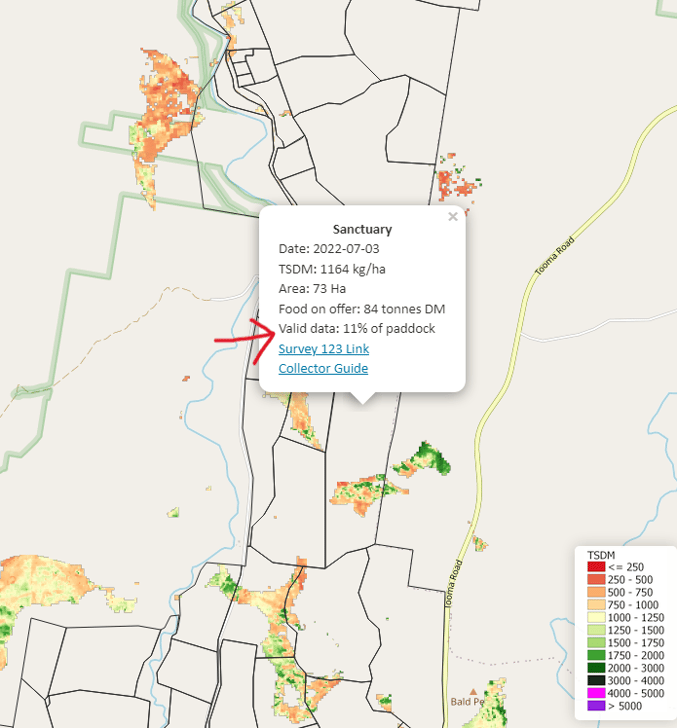
The PastureKey service uses Sentinel-2 satellite imagery captured every 5-days. On a cloud or fog affected day, the satellite cannot take an accurate reading of pasture biomass. As a result, your PastureKey webmap will look similar to the image below - where there are patches of estimated biomass, or sometimes no TSDM estimates at all.
When you click on a paddock, the 'Valid data %' indicates the % of the paddock pasture biomass that has been captured (red arrow below).

The best option is to wait for the next pasture biomass estimates to come through (new satellite images are taken every 5 days). You can also refer to your CSV file for the most recent, non-affected pasture biomass estimates.
If you have further questions about this, please email us at:
support@cibolabs.com.au
![PNG Transparent background-1.png]](https://support.cibolabs.com.au/hs-fs/hubfs/PNG%20Transparent%20background-1.png?width=215&height=76&name=PNG%20Transparent%20background-1.png)