![PNG Transparent background-1.png]](https://support.cibolabs.com.au/hs-fs/hubfs/PNG%20Transparent%20background-1.png?width=215&height=76&name=PNG%20Transparent%20background-1.png)
The integration with AgriWebb updates current FOO (Feed On Offer) estimates for paddocks.
The model uses satellite technology to estimate the kg DM/ha in your paddocks every 5 days at a 10 square metre resolution.
What Happens When it's Cloudy?
-
We give AgriWebb a value if the following conditions are true:
-
The current satellite image has at least one pixel with data
-
The last 45 days have had at least 4 images with some data
-
The model error, calculated by dropping out dates in the time series, divided by the model mean is < 0.5 (e.g. an estimate of 1000kg/Ha with 501kg/Ha error is rejected)
-
- Australian properties are imaged every 3-5 days.
- Local and seasonal cloud conditions are a challenge to any remote sensing.
- When it's cloudy we have to detect the clouds (~80% accuracy) and then try to predict pasture biomass.
- Winter in southern parts of Australia are challenging, especially in Tasmania!
- Imagery over the last month is used to inform and constrain predictions based on the amount of cloud cover and how recent the imagery is.
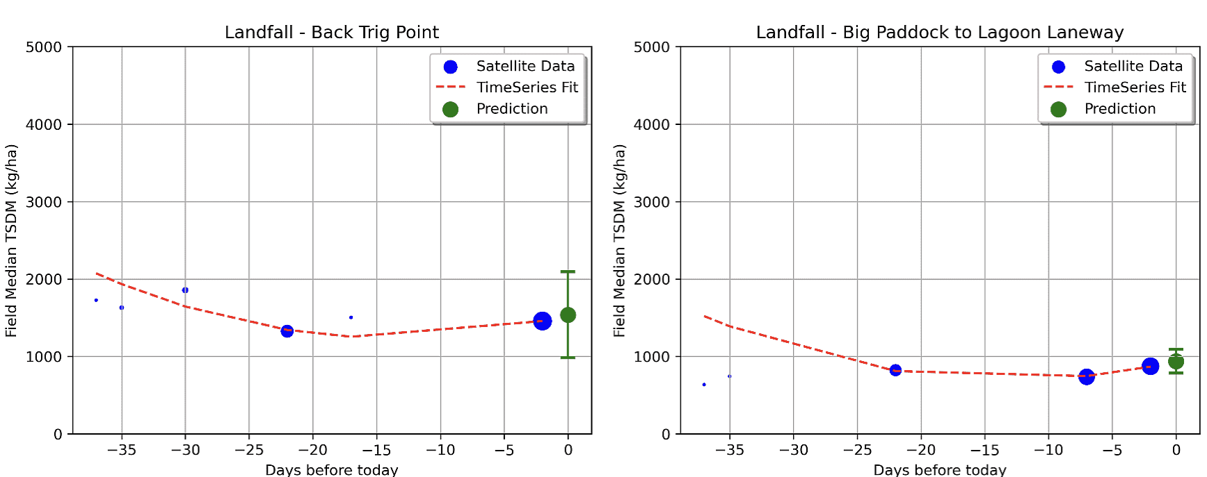
Example of estimation based on historical TSDM values:
Extract video of AgriWebb Integration presentation by Phil Tickle:
Example of estimates generated for a farm in Tasmania: