
MyFarmKey aims to unlock the benefits of digital agriculture across the supply chain – Linking data from paddock to plate.
Watch this Quick Start Video:
To open the MyFarmKey application - CLICK HERE
If you don’t have an account use the Sign-Up option at the bottom of the login screen. If the application does not open, please ensure you are using an up to date web browser, and preferably use the Chrome Internet Browser for the application if this is not your default browser. Detailed instructions are provided in the sections below.
Troubleshooting
-
If the application does not open, please ensure you are using an up to date web browser, and preferably use a Chrome Internet Browser for the application if this is not your default browser.
-
Please email support@cibolabs.com.au if you require technical support.
Creating your User Account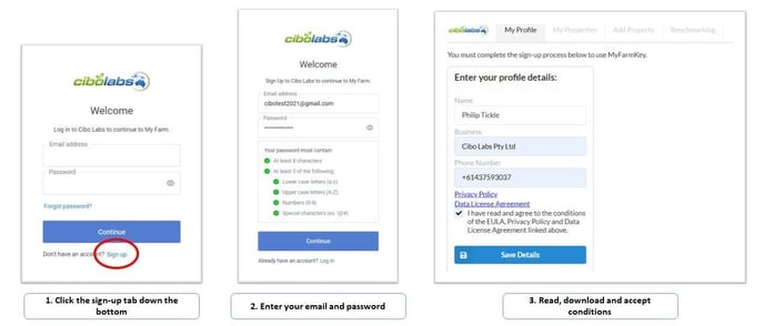
Click on the sign up tab, enter your details and agree to the conditions.
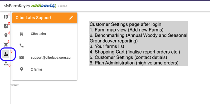
Navigating the MyFarmKey portal
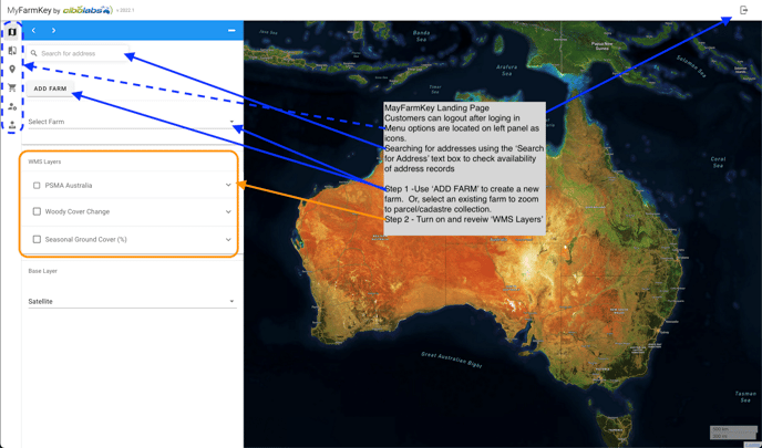
The Menu options are:
Creating the MyFarmKey with Cadastre Parcels
You can verify your property record against your LPA ID and Property Identification Code (PIC) which will allow your information to be linked together for future traceability and provenance applications that you may wish to undertake. You can complete the verification at any time.
If you choose to download your completed property MyFarmKey as geojson and/or kml files using the shopping cart prior to running a benchmark report the files will be placed in your download folder. Attach and email the 2 files to your service provider or collaborator for on-boarding. If you would like to view your MyFarmKey simply download Google Earth Pro and “drag” the kml file into the viewer. You can click on the MyFarmKey and see the records stored in the data file.
Displaying the Satellite Time Series Data
To display the Seasonal Ground Cover and Annual Woody Change data select the Time Series Data and simply set the time-slider for the date you want to look at.
Set the zoom level using the scroll wheel on your mouse. Alternatively, use the + or – button at the top left corner of the map.
Turn these layers off to select the parcels by clicking “X” in the Time Series Display.