![PNG Transparent background-1.png]](https://support.cibolabs.com.au/hs-fs/hubfs/PNG%20Transparent%20background-1.png?width=215&height=76&name=PNG%20Transparent%20background-1.png)
Introduction
The MyFarm Operations platform has been developed to provide consultants or groups (BYO Licences) with an easy to use environment for mapping and monitoring their properties or projects with the aim of:
-
Supporting day-to-day and strategic property management
-
Meeting regulatory requirements and emerging market and business requirements
-
Enabling cost-effective monitoring of pasture and vegetation and transparent reporting
-
Enabling easier integration with other digital agriculture technologies
-
Providing producers with an opportunity to be involved in the development of the tools to meet their needs and the broader industry
The MyFarm Mapper is built on the ArcGIS Online platform, using a Dashboard style environment for producers, groups and all other users.
Importantly, the MyFarm Mapper is in the early stages of development. We are seeking input from users to ensure that current functionality on the dashboard meets operational requirements and guidance on how the platform can be improved to meet both individual producer and industry needs. MyFarm is built on the ArcGIS Online ecosystem utilizing an operations dashboard.
The MyFarm Dashboard provides tools to:
- Create Biosecurity Maps, Farm Plan and Environmental Plans such as planning Carbon Estimation Areas (CAEs) or Biodiversity Plans
- Use satellite imagery to monitor ground cover and pasture biomass for forage budgeting and land condition assessment
- Map, monitor and report on seasonal ground cover and annual woody vegetation change.
The current MyFarm Dashboard contains 6 modules (tabs):
- (a) Property Onboarding; (b) Property Mapper (landing page) – create property infrastructure, biosecurity features and paddocks
- Property Projects - create environmental project areas for soils vegetation and carbon estimation.
- Select and Download - download your property data as CSV, geoJSON or KML
- Annual Woody Veg Map - vegetation and ground cover change monitoring
- Pasture Biomass Review
- PastureKey Service
- Custom Printing
- Historical World Imagery
Operations Portal Landing Page (BYO licence customers)
The landing page is where users first arrive when opening the MyFarm Operations. Below are some aspects of the platform:
- Left-hand side list – the tool display panel
- Left-hand side Tool panel - displays the operations
- Right-hand side map panel – the map display panel
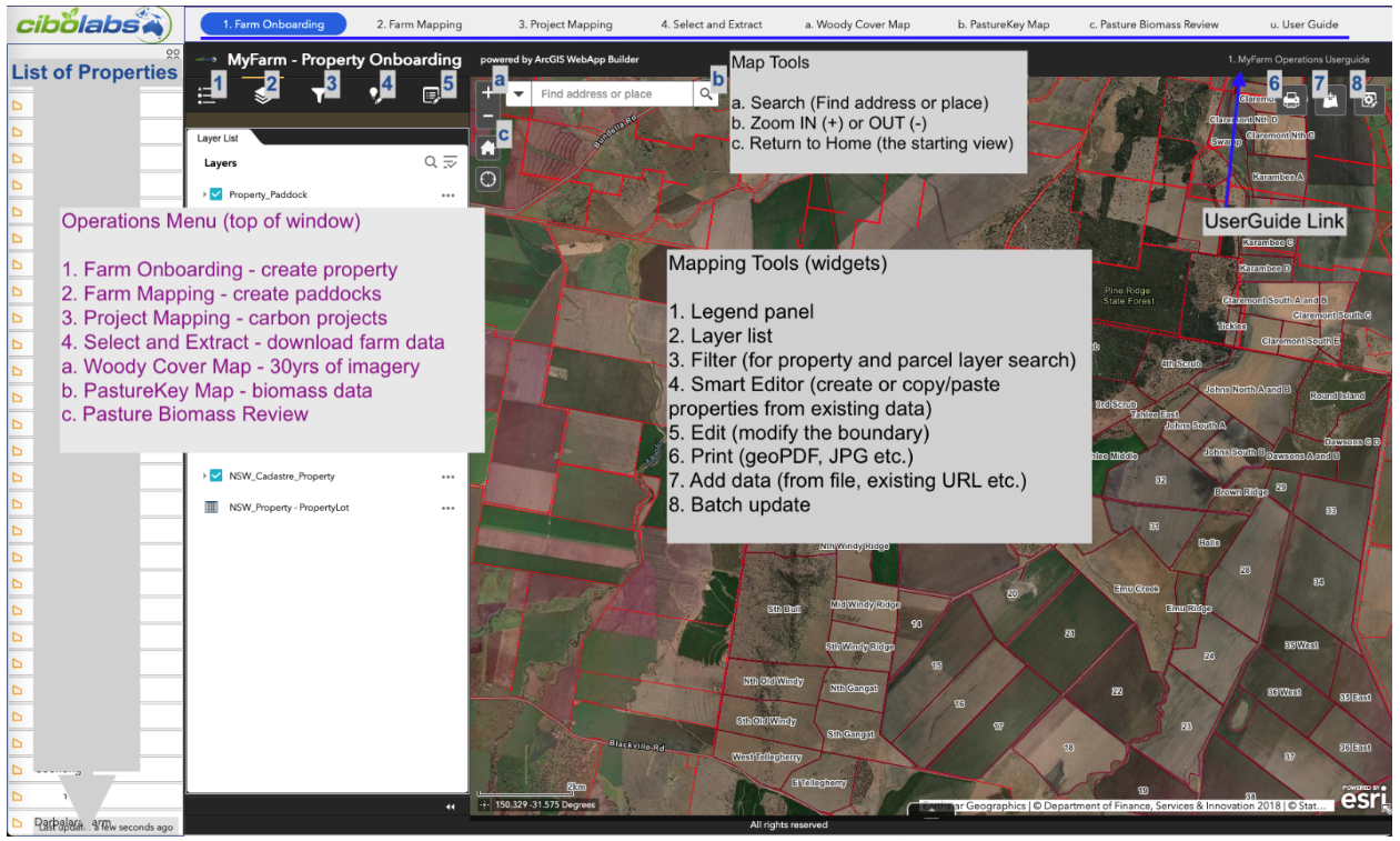
MyFarm Operations Platform - Landing Page Screenshot view with layer options, widget buttons & Mapping tools screen layout.
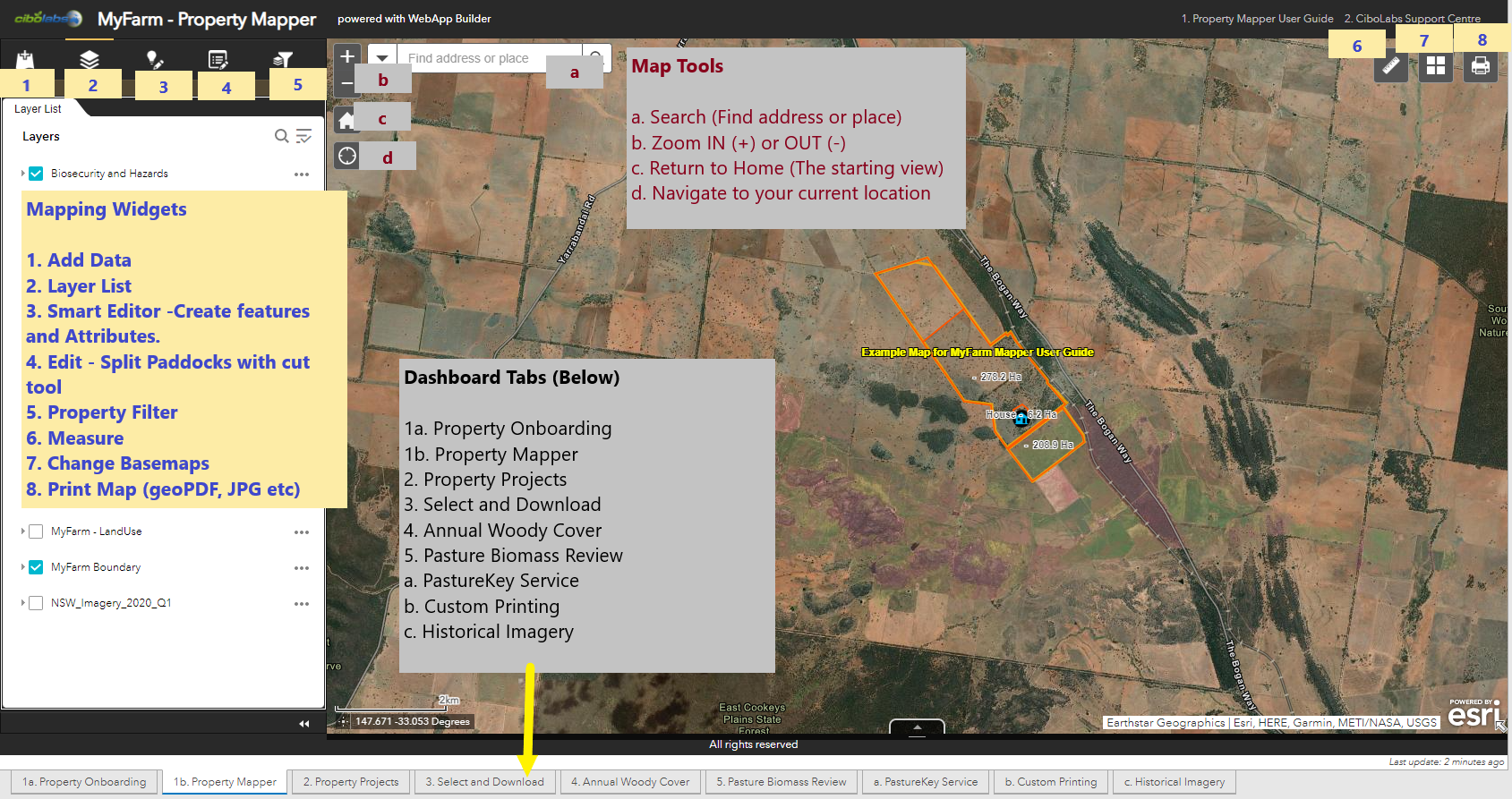
MyFarm Property Mapper - Landing page screenshot view and icons.
MyFarm Property Mapper Video - Introduction to the landing page.
For the general functions userguide, click the link