Managing your tags and visualising your data, please visit our app and login to your account.
![]()
The Cibo Labs CeresTag Portal - https://app.cibolabs.com/
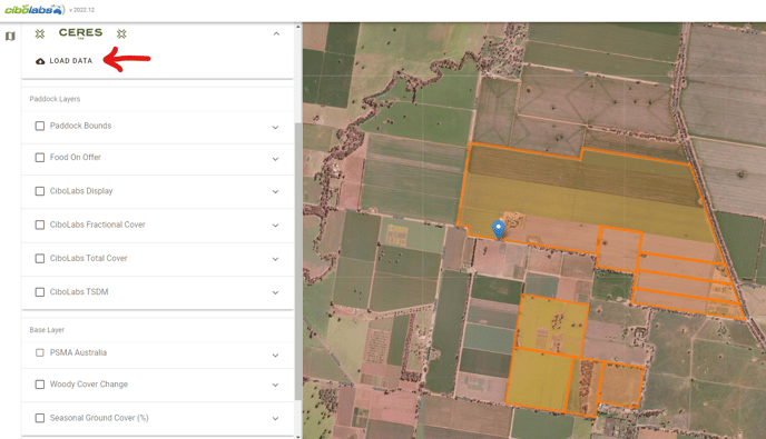
The landing page of the portal starts with a map that has a left drawer for selecting farms and visualizing tags and map layers. The Ceres Tag section in the map can expand to let you load the data and control the date and activity range of the shown tags and track tags on map.
LOAD DATA
Click the 'Load Data' button (as shown in image below) to load the most recent tag information. This will automatically show the animal locations from the last 24 hours.
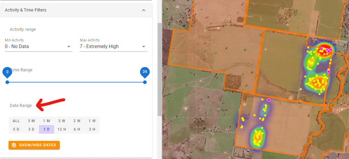
You can select the 'Activity & Time filter' dropdown, and change the date range to be displayed:
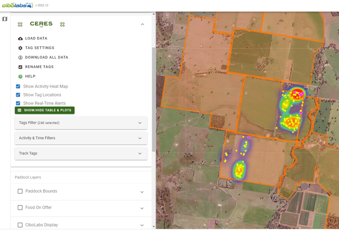
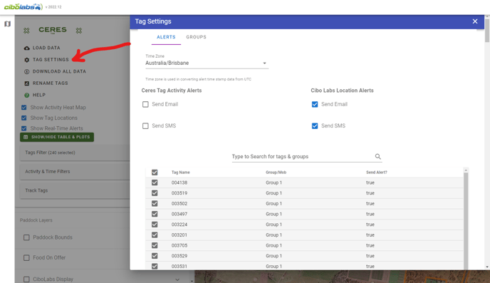
TAG SETTINGS
- In Tag Settings you can decide on the alerts you receive and how you receive them (SMS or email).
- Here you can also allocate your tags/animals to groups or mobs.
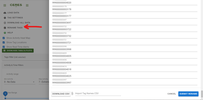
RENAME TAGS
- You can type in management numbers/visual IDs directly against the CERES tag numbers OR alternatively you can download a CSV file, enter the corresponding tag IDs then re-import the file.
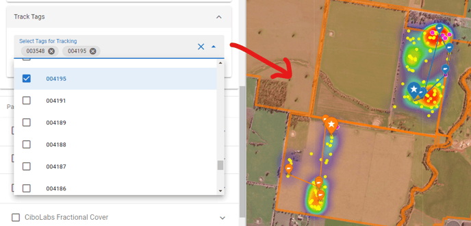
TRACK TAGS
- You can select individual tags to track them (you can select the tracking time in 'activity & time filters').
- The big star = the current animal location.
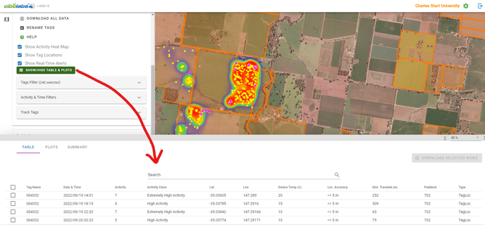
SHOW/HIDE TABLE PLOTS
- This presents to you the data that has been selected. It provides a tabular view of everything on the map. It shows animal activity levels and distances travelled.
- The 'Plots' tab gives you accelerometer data for the tags.
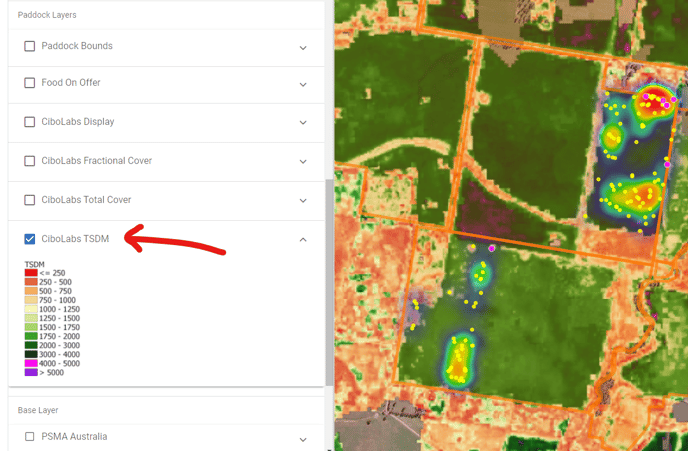
PASTURE KEY LAYERS
- There are a number of different pasture key layers provided within the integrated CERES tag-PastureKey platform. For a detailed description of these different layers, please check out our PastureKey User Guide.
- The TSDM (Total Standing Dry Matter) layer (shown below) provides you with an estimate of the kg DM/ha in your paddocks. You can have this layer turned on underneath your tag information to get an understanding of where your animals are spending most of their time grazing. Essentially it is a 'Pasture Utilisation Map'.